

Prototype Information
As you could guess, images of South Elkins before 1930 are very hard to find. A few books have been helpful, as have Sanborn Fire Insurance Maps. Here are a few vital parts that have come together.
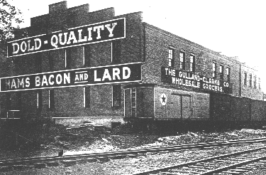
Livingston Avenue Industries
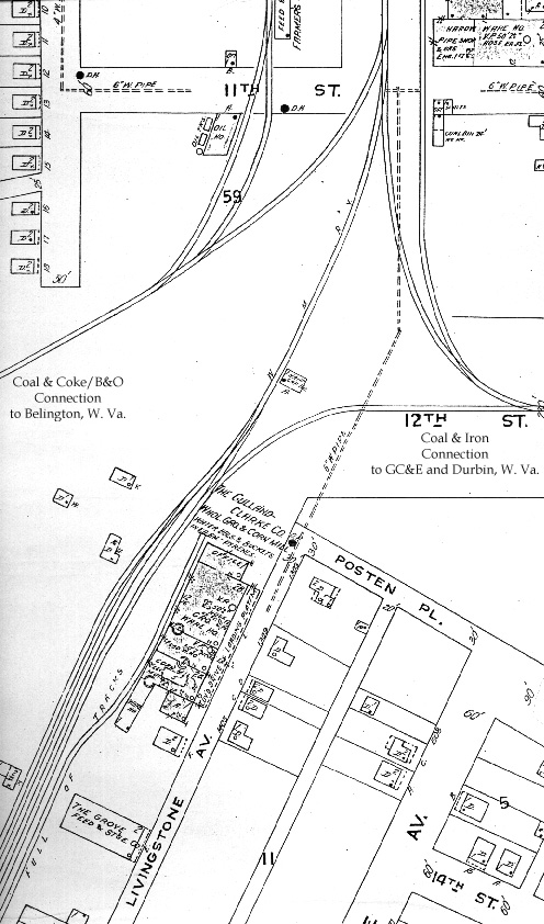
Between the Railroad Avenue industries and the Livingston Avenue industries was the wye trackage for the Coal & Iron connection to Durbin. The Sanborn Map below illustrates the relationship of these elements. The Randolph Planing Mill Company and Humphrey Manufacturing Company were on Livingston Avenue just south of the map image, but I have not found adequate images of these businesses to include the details here.
 |
|
Another quality Hansmann Production.
Direct your comments and/or questions to: 43admin@hansmanns.org
All content and images copyright 2006 by EWHansmann, unless otherwise indicated.
Direct your comments and/or questions to: 43admin@hansmanns.org
All content and images copyright 2006 by EWHansmann, unless otherwise indicated.